Monthly Archives: April 2012

Hail Storms for April 27th, 2012 as reported by Hail.Org. In House Adjuster Staffing keeping you in the know!

Hail Storms – Tennessee, Georgia, South Carolina, Kentucky, North Carolina, West Virginia, Texas, Nebraska, Virginia, Colorado, Oklahoma, Kansas, Pennsylvania

Reporting 63 storms in 13 states.

Storm #1

Location: CUMBERLAND, TN
Hail size: 1″
County population: 52344
County income: $34061

Storm #2

Location: BLEDSOE, TN
Hail size: 1″
County population: 13030
County income: $30444

Storm #3

Location: MCMINN, TN
Hail size: 1″
County population: 52020
County income: $35261

Storm #4

Location: MONROE, TN
Hail size: 1″
County population: 44163
County income: $34243

Storm #5

Location: TOWNS, GA
Hail size: 1″
County population: 10525
County income: $34767

Storm #6

Location: RABUN, GA
Hail size: 1″
County population: 16354
County income: $35441

Storm #7

Location: SEVIER, TN
Hail size: 2.75″
County population: 81382
County income: $37105

Storm #8

Location: YORK, SC
Hail size: 1″
County population: 199035
County income: $47351

Storm #9

Location: CHESTERFIELD, SC
Hail size: 1″
County population: 43191
County income: $30878

Storm #10

Location: MADISON, KY
Hail size: 1″
County population: 79015
County income: $36710

Storm #11

Location: MARLBORO, SC
Hail size: 1″
County population: 29152
County income: $27326

Storm #12

Location: JACKSON, KY
Hail size: 2.5″
County population: 13810
County income: $23140

Storm #13

Location: ROCKCASTLE, KY
Hail size: 1.75″
County population: 16857
County income: $27500

Storm #14

Location: ROBESON, NC
Hail size: 1″
County population: 129021
County income: $27241

Storm #15

Location: MARION, SC
Hail size: 1″
County population: 34684
County income: $26593
Find: DealershipsBody Shops and Hotels near NICHOLS, MARION, SC

Storm #16

Location: RUSSELL, KY
Hail size: 1.75″
County population: 17174
County income: $25510

Storm #17

Location: COLUMBUS, NC
Hail size: 1″
County population: 54637
County income: $28652

Storm #18

Location: SWAIN, NC
Hail size: 1.25″
County population: 13445
County income: $34123

Storm #19

Location: SIMPSON, KY
Hail size: 1.5″
County population: 17180
County income: $39738

Storm #20

Location: BREATHITT, KY
Hail size: 1.25″
County population: 15924
County income: $22571

Storm #21

Location: LOGAN, WV
Hail size: 1″
County population: 36218
County income: $28208

Storm #22

Location: ROBERTSON, TN
Hail size: 1.25″
County population: 62187
County income: $46379

Storm #23

Location: SUMNER, TN
Hail size: 1.75″
County population: 149416
County income: $48527

Storm #24

Location: MACON, NC
Hail size: 1″
County population: 32395
County income: $34501

Storm #25

Location: WAYNE, KY
Hail size: 1.75″
County population: 20504
County income: $25083

Storm #26

Location: ALLEN, KY
Hail size: 1.75″
County population: 18788
County income: $33541

Storm #27

Location: POTTER, TX
Hail size: 1″
County population: 121328
County income: $30294

Storm #28

Location: LAUREL, KY
Hail size: 1″
County population: 56979
County income: $30255

Storm #29

Location: WYOMING, WV
Hail size: 1.75″
County population: 24225
County income: $26595

Storm #30

Location: JACKSON, NC
Hail size: 1.75″
County population: 35562
County income: $33909

Storm #31

Location: MACON, TN
Hail size: 1.75″
County population: 21726
County income: $31955

Storm #32

Location: KNOX, KY
Hail size: 1.25″
County population: 32527
County income: $22503

Storm #33

Location: MCCREARY, KY
Hail size: 1″
County population: 17354
County income: $21822
Find: DealershipsBody Shops and Hotels near WHITLEY CITY, MCCREARY, KY

Storm #34

Location: MERCER, WV
Hail size: 1.25″
County population: 61278
County income: $28965

Storm #35

Location: SCOTTS BLUFF, NE
Hail size: 1.5″
County population: 36546
County income: $33995

Storm #36

Location: BELL, KY
Hail size: 1″
County population: 29544
County income: $22030

Storm #37

Location: SWISHER, TX
Hail size: 1.75″
County population: 7830
County income: $29755

Storm #38

Location: CLAY, NC
Hail size: 1.75″
County population: 10008
County income: $32781

Storm #39

Location: PICKENS, SC
Hail size: 1.75″
County population: 114446
County income: $38199

Storm #40

Location: TAZEWELL, VA
Hail size: 1″
County population: 44608
County income: $30576

Storm #41

Location: BRADLEY, TN
Hail size: 2″
County population: 93538
County income: $38003

Storm #42

Location: BUNCOMBE, NC
Hail size: 1.75″
County population: 222174
County income: $37738

Storm #43

Location: POLK, TN
Hail size: 1.25″
County population: 15939
County income: $32438

Storm #44

Location: WILSON, TN
Hail size: 1″
County population: 104035
County income: $54692

Storm #45

Location: PROWERS, CO
Hail size: 1.75″
County population: 13776
County income: $29647

Storm #46

Location: GREENVILLE, SC
Hail size: 1″
County population: 417166
County income: $42439

Storm #47

Location: RANDALL, TX
Hail size: 1.5″
County population: 111472
County income: $47377

Storm #48

Location: MADISON, TN
Hail size: 2.75″
County population: 95894
County income: $38351

Storm #49

Location: UNION, NC
Hail size: 1.25″
County population: 175272
County income: $56218

Storm #50

Location: RUTHERFORD, NC
Hail size: 1″
County population: 63867
County income: $32774

Storm #51

Location: TEXAS, OK
Hail size: 1″
County population: 20238
County income: $34500

Storm #52

Location: MONROE, WV
Hail size: 1.5″
County population: 13510
County income: $31069

Storm #53

Location: WILLIAMSON, TN
Hail size: 1.25″
County population: 160781
County income: $79692

Storm #54

Location: MORTON, KS
Hail size: 1.75″
County population: 3138
County income: $38969

Storm #55

Location: CARSON, TX
Hail size: 1.5″
County population: 6595
County income: $38724

Storm #56

Location: BACA, CO
Hail size: 1.5″
County population: 4017
County income: $26580

Storm #57

Location: FRANKLIN, PA
Hail size: 1″
County population: 139991
County income: $45454

Storm #58

Location: CHEROKEE, NC
Hail size: 1″
County population: 26309
County income: $30177

Storm #59

Location: HENDERSON, NC
Hail size: 1.75″
County population: 99033
County income: $40097

Storm #60

Location: DAVIDSON, TN
Hail size: 1″
County population: 578698
County income: $41981

Storm #61

Location: OCONEE, SC
Hail size: 1″
County population: 70567
County income: $39415

Storm #62

Location: STANTON, KS
Hail size: 2.75″
County population: 2232
County income: $39609

Storm #63

Location: ANDERSON, SC
Hail size: 1.75″
County population: 177963
County income: $38667

Tagged

What a success story! Satisfied Homeowner, Satisfied Contractor. IHAS increased A-1 Dallas’ profit by $3900.00 on ONE job!

IHAS negotiated with the insurance company to make A-1 Dallas an additional $3900.00 in supplements on this job.


Let our next success story be YOURS. They happen every single day here at In House Adjuster Staffing.

We’ve got the time and the expertise to make you money without an extra dime out of your bottom line.

Call us at 800.775.8667 today.


In House Adjuster Staffing would like to introduce 1st Priority Roofing in the Denver/Aurora area!

1st Priority Roofing has joined the IHAS team.

1st Priority Roofing is not only registered with the State of Colorado and the State of Kansas, but are also licensed and insured with each state and pull permits for all our re-roofing projects.  They are not a fly-by-night company chasing storms nor are they a huge conglomerate who set up shop here (in Colorado) after a storm.

For a great contractor in the Denver area, give them a call.

720.388.8281

Contractors, are you looking for better tips to give your door knockers on selling roofs? Here is a WONDERFUL resource we just found.

We have gone through many of the articles on this website and highly recommend it.  The easy to read (and funny) tips and tricks offered should make your salesmen better, more confident and more successful.

http://www.roofingsalesman.com/door-knocking-advice/

Here is an excerpt from the article linked above.

What are you saying?

There’s a sub-set of behavioral psychology that comes from the pioneers of psychotherapy called NLP (Neuro-Linguistic Programming). One of the fundamental teachings of NLP is that we use frames (yes, like picture frames) built from prior experience to interpret and understand the context of what happens to us in life.

Let me give you an example:

Suppose you just sat down to dinner with your wife and children. The phone rings and you pick it up even though nothing showed up on the Caller ID (because you’re curious). The caller immediately rattles off a phrase that sounds like this…

“Hello Mr Jones. This is ________ with ________. The reason I’m calling is because ________.”

Who is calling you?

If you answered, “a sales person”, you would probably be right. You based your answer on your life’s experience to build a frame to understand the context of that phone call. You’ve been interrupted at dinner with a phone call from a pushy sales person more than a few times in your life.

Before the caller ever gets to the reason why they’re calling, you already know they want to sell you something… and you’re “not interested!” click.

Re-Frame

Now, you may not have thought about it before, but now you know exactly what goes through the mind of your prospect as soon as they open the door and hear you say…

“Hello. My name is _________ with _______ roofing company. The reason I’m here is because _________.”

That’s exactly right… Click. Goodbye. Get out of my yard. Do not pass go. Do not collect $200.

They might smile when they tell you “NO!”, but you’ve just invoked the most powerful, negative, instinctive reaction that’s known to man. Your prospect used their past experience to interpret why you’re at their front door… and it didn’t turn out good for you.”

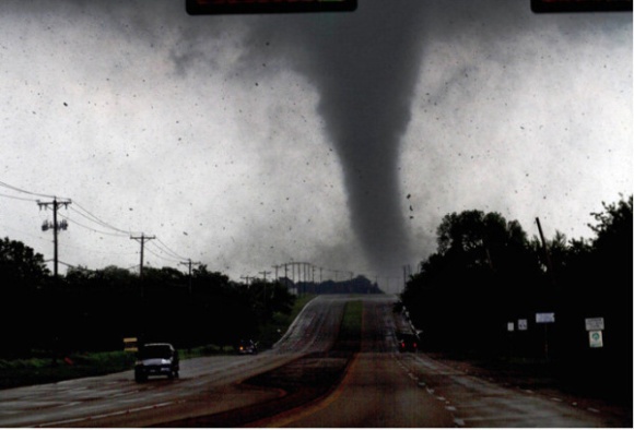
WOW! This weekend showed us some crazy weather. Contractors, are you ready to sell, sell sell?

http://www.usatoday.com/weather/storms/tornadoes/story/2012-04-15/tornadoes-midwest-storms/54290010/1


CRESTON, Iowa – The death toll rose to six Monday from a series of violent storms that ripped across much of the Midwest over the weekend, injuring dozens of people and reducing homes and lives to rubble.

Oklahoma Department of Emergency Managementspokeswoman Keli Cain said a sixth person has died after a tornado ripped through the northwest Oklahoma town of Woodward.

No details were released on the latest death from a twister that already had claimed the lives to two men and three children.

There were at least 120 reports of tornadoes Saturday and early Sunday, primarily in Kansas but also in northwest Oklahoma, Nebraska and Iowa, the National Weather Service said.

Forecasters at the Storm Prediction Center in Norman, Okla., warned of more tornadoes or severe storms could come Monday, the most dangerous likely in Wisconsin, Minnesota and Iowa.

Woodward bore the worst of the storms. Thirty people were injured and City Manager Alan Riffel said 89 homes and 13 businesses were destroyed. Bloodied survivors in the 12,000-resident town emerged to find flipped cars and smashed trailers.

The American Red Cross set up a shelter and planned to dispatch mobile feeding trucks to neighborhoods and offer assistance to weary residents.

“This was a horrific event, but I’ve come across people in the neighborhoods in high spirits because they’ve got their lives,” says Rusty Surette, a spokesman for the Central and Western Oklahoma region of the American Red Cross, which also opened a shelter in Norman, where a tornado struck Friday.

Two tornadoes touched down in southwest Iowa late Saturday, including one here in Creston, the National Weather Service confirmed.

“We didn’t receive any warning,” Police Chief Paul Ver Meer said.

There were no deaths, though, and only minor injuries, he said. Two homes were destroyed, and a hospital and other buildings were damaged.

Another unconfirmed tornado is believed to have devastated the southwestern Iowa town of Thurman, where at least 75% of the homes were wiped out or damaged.

“It’s a royal mess,” said Mike Crecelius, director of emergency management for Fremont County. But no fatalities or injuries were reported.

Some 97 tornadoes swept through Kansas, leaving a dozen people injured but causing no deaths, said Steve Larson, spokesman for the adjutant general, who oversees the state’s emergency management.

Gov. Sam Brownback declared 37 counties in the central part of the state to be disaster areas. On Sunday, he flew to Wichita and nearby communities to see the damage first-hand, Larson said.

HOLY HAIL BATMAN! West Texas Gets FOUR FEET of HAIL!

http://usnews.msnbc.msn.com/_news/2012/04/12/11160993-4-feet-of-hail-in-texas-reports-photos-cause-quite-a-storm?lite


4 feet of hail in Texas? Reports, photos cause quite a storm


Devin Singleton / KAMR

Meltwater rushes past hail several feet thick on Wednesday off Highway 287 north of Amarillo, Texas.

By Miguel Llanos, msnbc.com

Sure, everything’s bigger in Texas. But 4 feet of hail from one storm? That’s what the National Weather Service, the Texas Department of Transportation, a local sheriff and others say happened Wednesday in an area north of Amarillo when hail piled up in drifts so wide they cut off a major highway.

The National Weather Service office in Amarillo even posted a photo on its Facebook page, but that wasn’t enough to convince skeptics.

“Serious do not think this is 100% hail!!!” commented one person.

“It’s a lite dusting of hail on some damn rocks,” said another person, referring to the image of a firefighter standing next to what could be taken for boulders.

Potter County Fire Department via NWS

The National Weather Service’s office in Amarillo, Texas, posted this photo Wednesday night of a firefighter standing next to deep hail.

“I can assure you we do not have big rocks like that in West Texas,” Krissy Scotten, a spokeswoman for the weather service office in Amarillo, told msnbc.com.

“That was 4 feet of ice” that was compacted by rain and floodwater across a wide area, she added.

“It was actually the rain/water that caused the drifts,” Scotten said. “Anytime you have hail accumulate 2 to 4 feet high and get over three inches of rain, no matter how it occurs, it’s pretty incredible.”

As for the darkish color, “we’re very dusty around here” due to drought so the hail quickly darkened, Scotten said.

The image, she added, was sent by the Potter County Fire Department and the firefighter seen in it is standing where meltwater had cut through the hail.

The Texas Department of Transportation confirms it was deep hail dumped by a storm that dropped visibility to near-zero at times.

Texas Department of Transportation

This highway webcam image was taken at 4:10 p.m. local time Wednesday and shows hail on Highway 287.

“Heavy rain and up to 4 ft of hail has US 287 blocked north of Amarillo,” it tweeted Wednesday afternoon.

The local sheriff concurred as well.

“You’re looking at four foot deep” hail in one stretch, NBC affiliate KAMR-TV quoted Brian Thomas, sheriff of Potter County, as saying. “This was just one of those weird storms that just sat here and came down extremely heavy in this one area.”

Amarillo TV station Pronews 7 even shot video of flash flooding triggered by the pea-sized hail and several inches of rain.

“It looked like soap suds,” said Pronews 7 meteorologist Steve Kersh. “The storm was moving really slow and a combination of the pea-sized hail and four to six inches of rain created those conditions.”

KAMR-TV reported that snow plows were called out to clear roads. Highway 287 was shut down for hours after the storm due to the cleanup.

Several vehicles got stuck in the flash flooding, and two feet of water also swamped a stretch of Highway 136, the weather service reported. One Chevy Tahoe, a large SUV, got stuck in hail up to its hood, Scotten said.

Krissy Scotten / National Weather Service

Covered in dust, this hail drift measured six feet high on April 12 and was still intact a day after it formed near Dumas, Texas, the National Weather Service said.

The pea-sized hailstones weren’t big enough to set any size records, and Scotten said the service doesn’t keep records for most hail in a given period.

But Jose Garcia, chief forecaster at the weather service in Amarillo, told msnbc.com it probably wasn’t the most hail the region has seen.

“Five to 6 feet deep hail” fell in nearby Dalhart, Texas, in 1993 during a very similar storm, he said. It took almost a month for some roads to reopen as the compact ice melted slowly. “It was almost like huge snow drifts,” he said.

Severe Weather Outbreak – Contractors, be aware!

From Weather.Com
Severe weather outbreak possible this weekend
Mark Avery, Lead Meteorologist, The Weather Channel
Apr. 13, 2012 5:10 am ET

An upper level system, currently in the West, is forecast to interact with a surface system currently in the Plains over the weekend and bring the threat of severe thunderstorms to much of the middle of the country by Monday morning.

Today, the upper level system will bring widespread rain and mountain snow across the West, while the surface system will be the trigger for storms from West Texas to the western Great Lakes by tonight.

Severe storms are possible by this afternoon in southern Kansas and much of Oklahoma, expanding eastward tonight into Missouri and southwestern into western Texas.

The threat of severe storms will be more widespread Saturday and Saturday night.

On Saturday, severe storms are possible by the afternoon hours from the Red River Valley to the Upper Mississippi Valley: this includes cities such as Oklahoma City, Wichita, Omaha, Kansas City, Des Moines, and Minneapolis.

By Saturday night, the threat of severe storms should stretch from the Big Bend of Texas to Lake Michigan: including all of Iowa, much of Kansas and Oklahoma, eastern parts of Nebraska and South Dakota, northern Missouri, northwestern Illinois, and southern Minnesota.

On Sunday, the threat of storms will stretch from the Rio Grande Valley through the Great Lakes, with the greatest risk of severe weather from northeastern Texas through northern Illinois: this includes cities such as Dallas, Tulsa, Kansas City, St. Louis, and Chicago.

In addition to the threat of severe weather (damaging winds, large hail, and tornadoes), locally heavy rainfall is also possible with any storms that do develop.

The system will make its way through the Eastern U.S. early next week bringing storms to areas east of the Mississippi River: the threat of severe weather, however, seems to be lower early next week than it will be over the weekend.

CURRENT JOB OPPORTUNITIES WITH In House Adjuster Staffing

CURRENT JOB OPPORTUNITIES WITH IHAS

CONTRACTORS: We are currently accepting applications nationwide for new contractors!
Click Here to inquire about your In House Adjuster.


INDEPENDENT ADJUSTERS: We have immediate openings at our corporate office in Colorado Springs, CO.

The Feb/March Storms were heavier than normal so WE NEED PEOPLE NOW.

Click here to learn more and apply to join our team.


REGIONAL SALES MANAGER: The regional sales manager position is responsible for sales, support, and training.

Click here to and apply to join our team – NOTE THAT YOU INTERESTED IN THE REGIONAL SALES MANAGER POSITION.


LOCAL SALES MANAGER: The local sales manager position is responsible for sales, support, and local marketing to contractors.

Click here to and apply to join our team – NOTE THAT YOU INTERESTED IN THE LOCAL SALES MANAGER POSITION.


LOCAL & NATIONAL SALESMEN:  IHAS is now hiring in the Dallas/Ft. Worth area!

Business to Business sales.

Leads provided in your area. Residual commissions mean more money in your pocket per sale. Must have experience in roofing construction, estimating, or insurance adjusting. Experience with insurance restoration preferred. Training provided, regional sales manager position is available with proven track record with IHAS.

Click here to and apply to join our team – NOTE THAT YOU INTERESTED IN THE SALESMAN POSITION.

Dallas Area Contractors! Let us do your insurance supplements at no cost to you!! Don’t leave money on the table!

GET PAID MORE, GET PAID FASTER, GET BACK TO SELLING!

Are you tired of paying to train your office staff to write supplements and only getting poor results?

Let us negotiate with insurance companies to increase your profits.

We have highly trained staff that understand the insurance business.

We can help you on each and every detail of the repair process.

STOP LEAVING MONEY ON THE TABLE.

IHAS DOES NOT GET PAID UNLESS WE GET YOU MORE MONEY.

Visit our web site and check out our many social media outlets.

To speak with someone now, call Scott @ 850.232.4634

Dallas Area Contractors! Let In House Adjuster Staffing handle your paperwork!

Stop walking away from money that’s rightfully yours!! Let IHAS handle your insurance supplements, negotiations and billings FOR YOU. We don’t make a PENNY unless we make you money.

Dallas area contractors!! What are you waiting for? Get out selling NOW and let IHAS do your back office paperwork. Let us take it off your hands so you can get more contracts in your hands.

www.ihasllc.com